B4UFLY Service
-
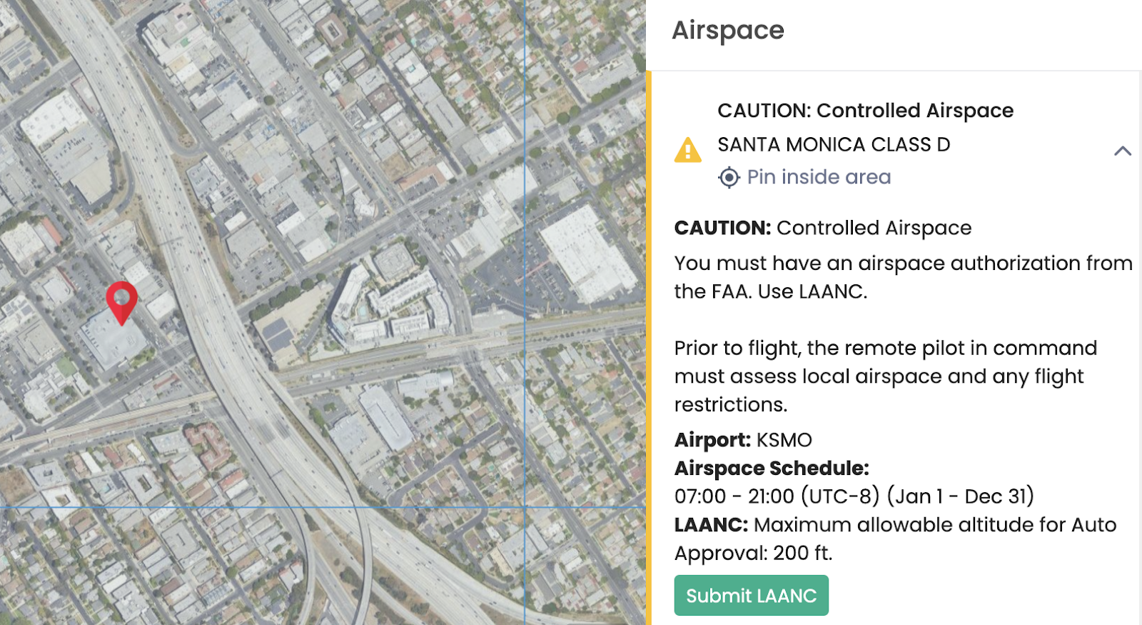
The map will default to the current location, which can be changed via the “search location” box. Drop the pin with the left click of the mouse and review the list of Advisories in the right-side panel. Each item on the list is expandable and will display additional details such as warning type, facility information, and distance to the pin.

-
UAS Facility Maps are always visible on the map. Airports, Heliports, NOTAMS and other UAS zones are marked with the yellow icon on the map. To view the details and related geometry, right-click on the icon or expand the advisory in the right panel.
-
To submit LAANC Authorization, expand the “Controlled Airspace” advisory in the right panel and click the “Submit LAANC'' button. Note that LAANC Authorization submission will prompt the user to create the Avision account.